Route Cerro del Telégrafo Hill
Panoramic view of the Guadarrama summitsRoute data
Distance: 6,4 km.
Starting point: km. 6 on the M601, Villalba-Puerto de Navacerrada
Slope: approximately 370 m.
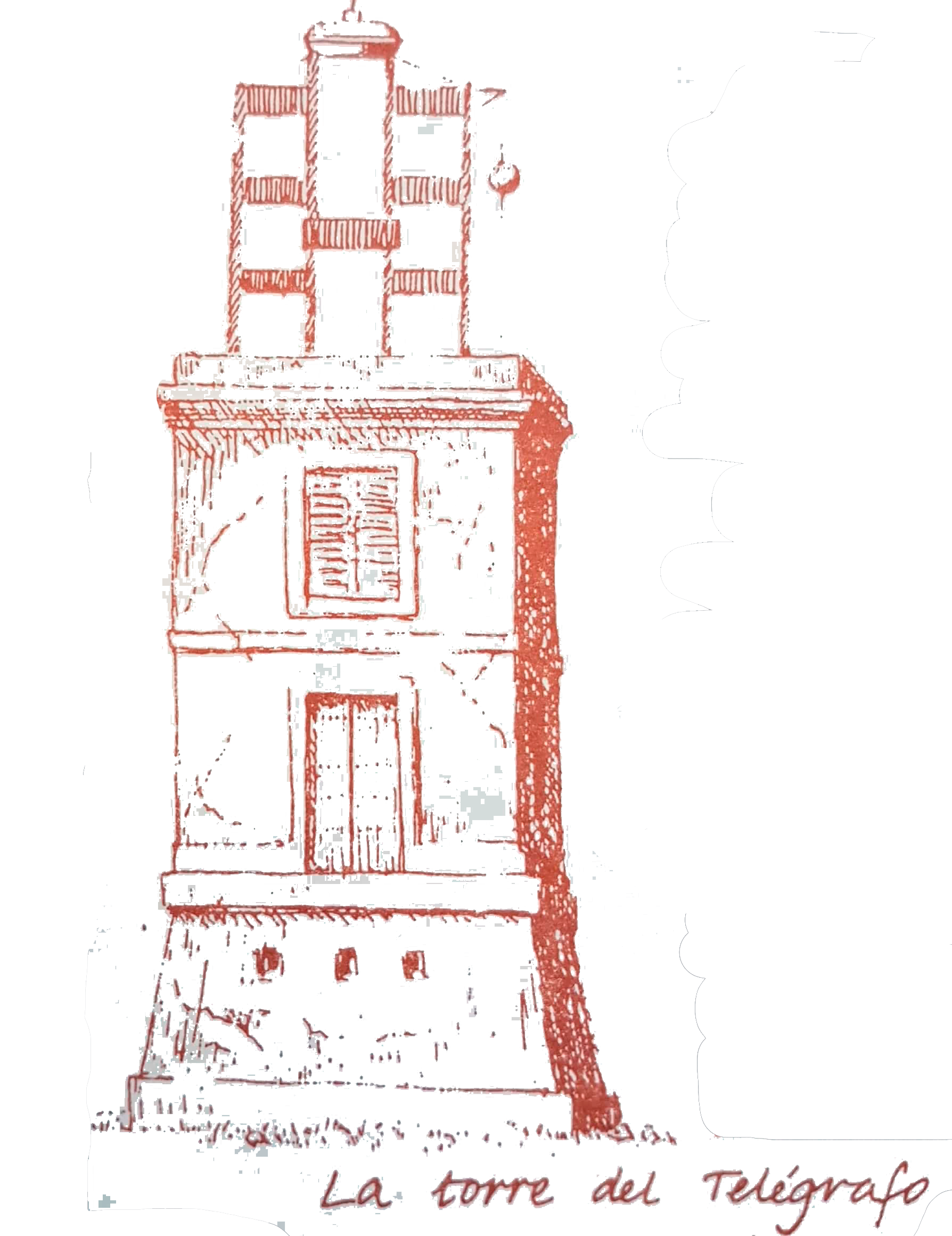
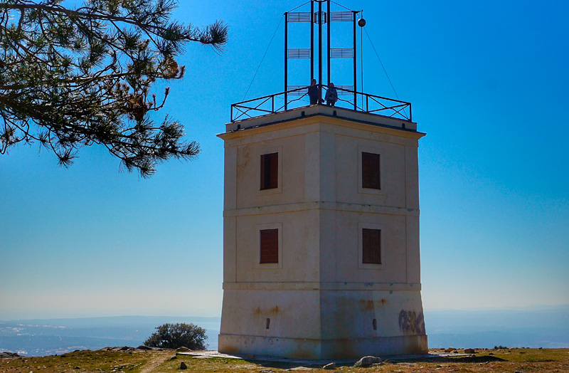
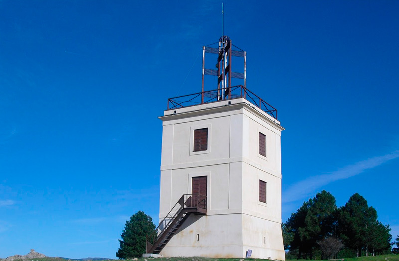
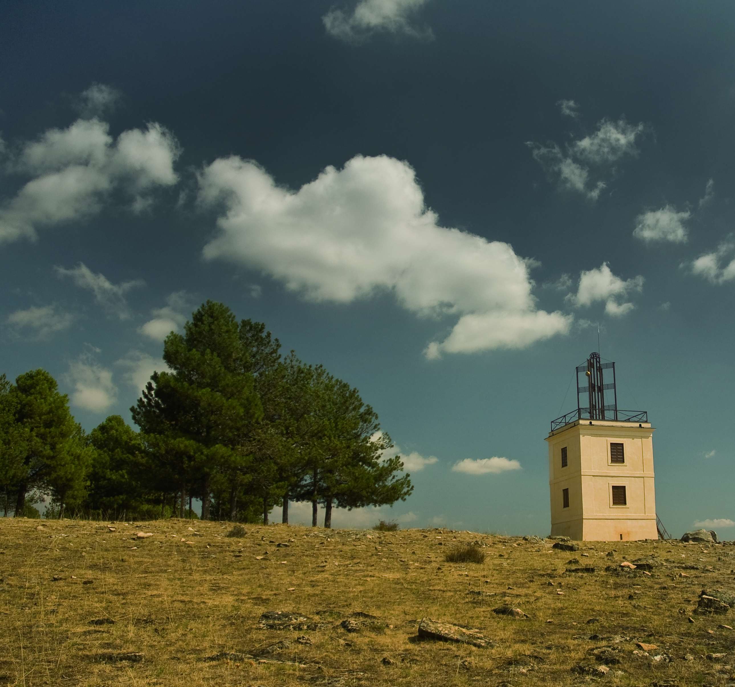
On the Cerro del Telégrafo there is a tower that was part of a message transmission system via optical telegraphy. This was formed by a series of towers 2.5 leagues apart (each league is 5.58 km).
The signals varied according to the position of a moving part with respect to another fixed part, which was observed by the operator of the next tower and reproduced in the same way. The message was deciphered at the destination using established codes. In each tower there used to be two or three tower operators, some of whom had to remain permanently alert. The Telegraph Tower in Collado Mediano belonged to the Madrid-Valladolid-Burgos line. It began operating in the early 1840s and probably ceased in 1852, the year in which the electric telegraph came into service, which allowed transmission both day and night.
The starting point of this circular route up to the summit of Cerro del Telégrafo is located on the rural road on the access roundabout to Collado Mediano on the M-601. You can park your car as you leave the roundabout on the side of the old road and take the track known as the Camino del Rehoyo, which starts in a south-easterly direction crossing a cattle pass.
You then continue slightly uphill along the main track, passing a dogs’ home on your right and then to your left a large cattle farm known as Las Cercas del Rehoyo, whose perimeter wall will always be to your left – now rising more steeply – always following it anti-clockwise.
You now cross another cattle grid, passing on the right the path up to the Cerro del Telégrafo, and which ascends the western slope of the mountain along the same track, always parallel to the wall of the cattle farm, until you reach the upper part of the farm. After a steep slope, this is now a much flatter area with wonderful views over the valley.
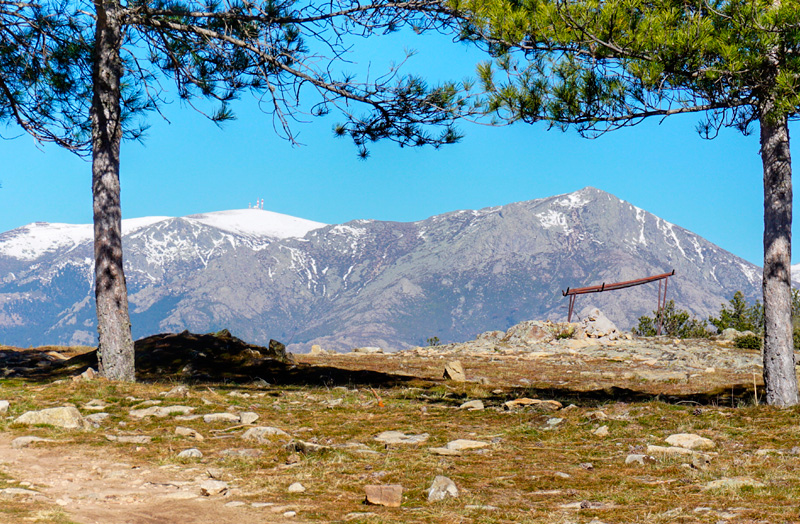
At this point, at a height of 1,140 m, take a broad signposted path to your right towards the southeast that goes into the pine forest in the direction of the slopes of the hill. Leave this path after barely 200 m when it turns sharply northwards, and take a much narrower path that starts at the apex of the curve, and continuing in the same direction as before, heads into a valley that will take you to the summit. This path will take you to the top of the hill and offers spectacular views over Collado Mediano and the southern slope of the Guadarrama. Immediately you will see the Telegraph Tower on the summit of the hill at an altitude of 1,325 m with unbeatable 360° views of the Guadarrama mountains.
Then, from the tower take the main access route to the Cerro del Telégrafo northwards from Moralzarzal, and turn off immediately after a firebreak on a path that follows the line of the mountain range parallel to the track and then crosses it twice.
As soon as you cross the track for the second time, and after crossing a cattle grid, continue along the firebreak for another 100 metres, and take a small path on your left at 1,290 m, which goes back into the pine forest. This track brings you back to the main Cercas del Rehoyo track on which you arrived. Take it to the left to return to the car park.